Property Record
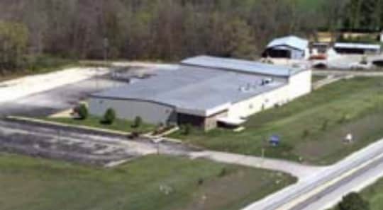
11 Eaton St, Parsons, TN 38363
NEARBY LISTINGS FOR SALE OR LEASE
Property Detail
11 Eaton St
Commercialnec
DISTRICT: 06, COUNTY AREA: I01
X
Decatur
47135C0125D
Tennessee
0
11.16 AC
2025
Tennessee West Area
955001
Other Market Areas
42,552 SF
043-009.05
DEMOGRAPHICS near 11 Eaton St
1 Mile
3 Mile
5 Mile
2024 Total Population
98
2,221
4,864
2029 Population
100
2,235
4,927
Pop Growth 2024-2029
+ 2.04%
+ 0.63%
+ 1.30%
Average Age
44
43
44
2024 Total Households
42
942
2,066
HH Growth 2024-2029
+ 2.38%
+ 0.42%
+ 1.11%
Median Household Inc
$42,500
$42,083
$40,788
Avg Household Size
2.30
2.30
2.30
2024 Avg HH Vehicles
2.00
2.00
2.00
Median Home Value
$118,750
$106,291
$114,035
Median Year Built
1983
1979
1980
Nearby Places
Map Layers
Map Styles
 Street
 Aerial
- Restaurants
- Banks
- Shops
- Fitness
- Groceries
SALE & LEASE HISTORY
LISTING DATE
SALE/LEASE

Sep 24, 2016
For Lease
Sep 24, 2016
For Sale
Nearby Properties
Address
Land Use
TOTAL SIZE
Lot Size
Zoning
Address
Land Use
TOTAL SIZE
Lot Size
Zoning
23,308 SF
320 AC
B1
Address
Land Use
TOTAL SIZE
Lot Size
Zoning
7,368 SF
1.64 AC
Address
Land Use
TOTAL SIZE
Lot Size
Zoning
10,260 SF
9.09 AC
M1
Address
Land Use
TOTAL SIZE
Lot Size
Zoning
21,948 SF
17.90 AC
M1
Address
Land Use
TOTAL SIZE
Lot Size
Zoning
11,182 SF
315 AC
B2
Address
Land Use
TOTAL SIZE
Lot Size
Zoning
16,773 SF
420 AC
B2
Address
Land Use
TOTAL SIZE
Lot Size
Zoning
18,922 SF
2.32 AC
Address
Land Use
TOTAL SIZE
Lot Size
Zoning
19,480 SF
4.01 AC
Address
Land Use
TOTAL SIZE
Lot Size
Zoning
24,248 SF
6.16 AC
M1
Address
Land Use
TOTAL SIZE
Lot Size
Zoning
10,530 SF
6.23 AC
Address
Land Use
TOTAL SIZE
Lot Size
Zoning
5,918 SF
1.40 AC
B1
Address
Land Use
TOTAL SIZE
Lot Size
Zoning
12,400 SF
1.22 AC
B1
Address
Land Use
TOTAL SIZE
Lot Size
Zoning
19,612 SF
201 AC
B1
Address
Land Use
TOTAL SIZE
Lot Size
Zoning
18,519 SF
7.80 AC
B1
Address
Land Use
TOTAL SIZE
Lot Size
Zoning
3,108 SF
0.52 AC
Address
Land Use
TOTAL SIZE
Lot Size
Zoning
1,008 SF
2.10 AC
Address
Land Use
TOTAL SIZE
Lot Size
Zoning
17,064 SF
245 AC
B1
Address
Land Use
TOTAL SIZE
Lot Size
Zoning
2,691 SF
5.80 AC
B1
Address
Land Use
TOTAL SIZE
Lot Size
Zoning
7,616 SF
1.81 AC
B1
Address
Land Use
TOTAL SIZE
Lot Size
Zoning
5,269 SF
2.70 AC
B1
Address
Land Use
TOTAL SIZE
Lot Size
Zoning
15,120 SF
450 AC
B1
Address
Land Use
TOTAL SIZE
Lot Size
Zoning
2,400 SF
3.58 AC
B1
Address
Land Use
TOTAL SIZE
Lot Size
Zoning
6,216 SF
2.15 AC
B1
Address
Land Use
TOTAL SIZE
Lot Size
Zoning
17,100 SF
160 AC
B1
Address
Land Use
TOTAL SIZE
Lot Size
Zoning
40,640 SF
4.88 AC
M1
Address
Land Use
TOTAL SIZE
Lot Size
Zoning
5 AC
B1
Address
Land Use
TOTAL SIZE
Lot Size
Zoning
1,519 SF
1.69 AC
Address
Land Use
TOTAL SIZE
Lot Size
Zoning
6,048 SF
1.64 AC
Address
Land Use
TOTAL SIZE
Lot Size
Zoning
3,864 SF
160 AC
B1
Address
Land Use
TOTAL SIZE
Lot Size
Zoning
5,182 SF
1.80 AC
B1
The World's #1 Commercial Real Estate Marketplace
Connect with us
© 2025 CoStar Group
The information above has been obtained from sources believed reliable. While we do not doubt its accuracy we have not verified it and make no guarantee, warranty or representation about it. It is your responsibility to independently confirm its accuracy and completeness. Any projections, opinions, assumptions, or estimates used are for example only and do not represent the current or future performance of the property. The value of this transaction to you depends on tax and other factors which should be evaluated by your tax, financial, and legal advisors. You and your advisors should conduct a careful, independent investigation of the property to determine to your satisfaction the suitability of the property for your needs.